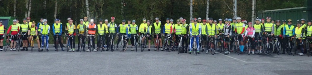
During this year’s Transcontinental race over 50% riders [citation needed] used Garmin navigators for finding their way. Also it is fair to say everyone had some problems with their navigation. Most of the problems were just imcompetence, poor planning, lag of attention or wrong decisions. Navigating through Europe on your own is not easy task for anyone. The problems do however underline two things.
One. There is no real option for Garmin right now so we are stuck with it. I can ride by street signs, paper maps or cue sheets, but I’d be riding on bigger roads and it is significantly slower. Mobile phone navigation apps are trash because of user interface and battery life issues. And the competition. Ugh. Magellan/Mio go home and see your next year.
Two. Even the best in the market is unsuitable for long distance/audax riding. While it is obviously possible to find my way with Garmin, it should not be dangerous, distracting and complicated.
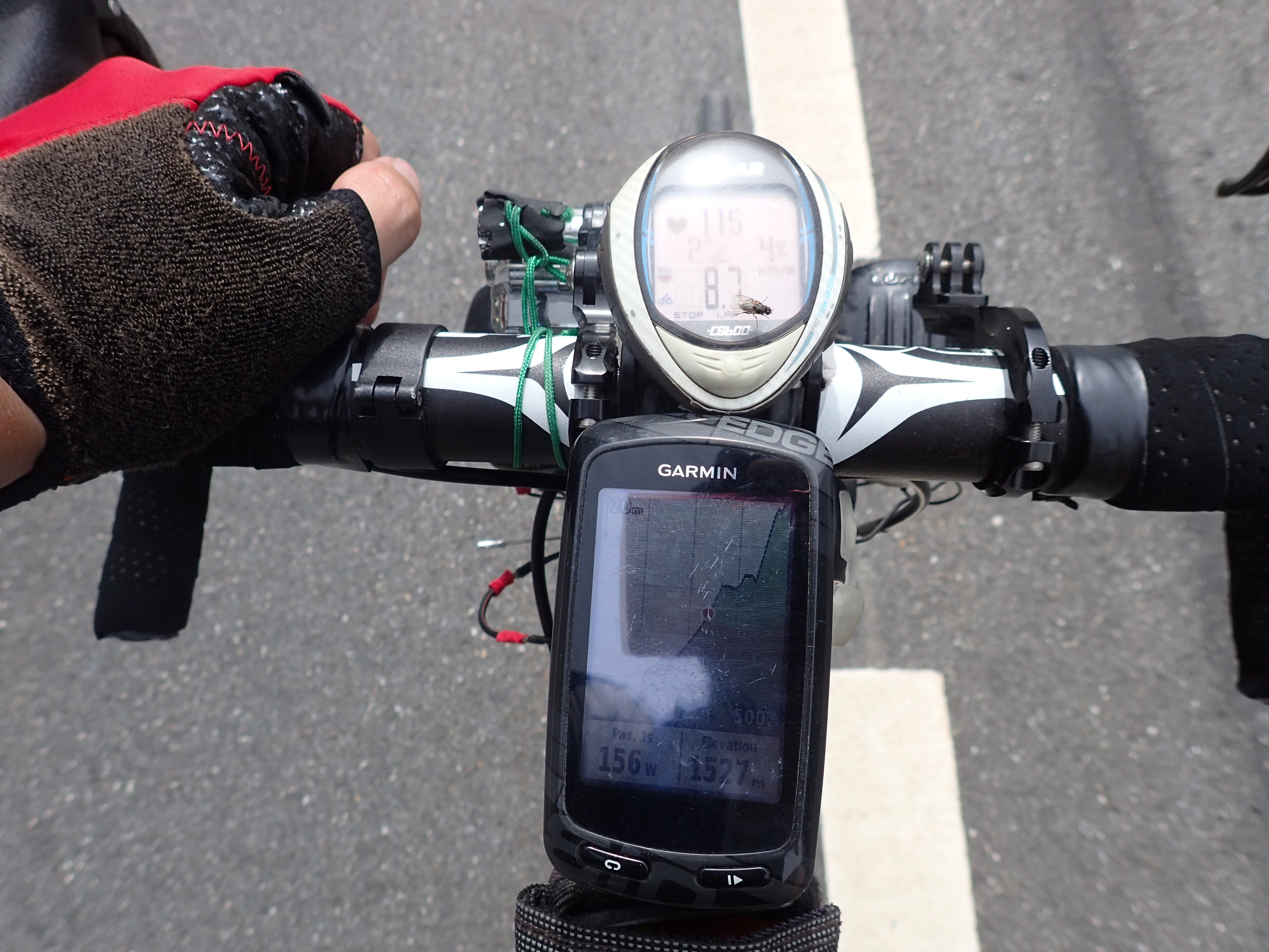
I use Garmin Edge 810 for navigation. Polar CS600 was there because Edge is unsuitable for tracking distance and heart rate.
So lets get started. I will repeat this issue again later! Why on earth would I want the device to power off when charging ends? To keep my Garmin juiced up I need to charge it. Obvious way to charge it is dynamo. When I slow down the dynamo will not give enough current so charging stops. What does Garmin do? It gives me 15 seconds to click ”No” or it powers off. And why would a cyclist slow down? In uphills, red lights, intersections and cities where they… navigate. During this year’s Transcontinental I restarted my Edge 810 more than 100 times. Mostly it didn’t matter, but still it adds up so that I spent maybe an hour waiting for Garmin to catch up. It is dangerous and distracting to play with Garmin in traffic. But why don’t I use power bank or something else for charging as dynamo doesn’t work properly? Well. I could, but why the heck should I? This is a problem caused by Garmin’s retarded design choice that they can fix with a simple firmware upgrade. No warnings. Please?
The device is a navigator, but could it please stop navigating? Most of us spent hours or even days planning our route. I absolutely don’t want the navigator to try to guess where I want to go. Just show to route and shut up. How about a simple way to turn off ”navigation” and turn-by-turn instructions? In brevet cycling it might be even against the rules to leave the route. Just show the planned route! Well. There is a way to do this. Stop course and choose a new one. The old course will stay on the map in colour I chose. However I will lose two important features. Upcoming elevation profile and distance to destination. After I start the new exercise and load the new course I’ll just have to wait for the blessing of ”Route calculation error”. After that the device surprisingly work’s as I wanted it in the 1st place. Maybe replace ”lap” button with ”inject route calculation error” button? That would be a lot more useful. And for no obvious reason loading a course also overrides activity profile’s navigation preferences to ”cycling” which in most cases means 200 km of u-turning. I could keep going forever about this issue. There are a few ways, other than waiting for ”route calculation error”, that sometimes work. Turn gps off before loading a new course and turn gps back on. However you’ll have to turn gps off every time you continue exercise after reboot. Remember the device usually powers off when I slow down. And there is the other way. I love this one. Load both OSM and City navigator maps to memory card and set both enabled. Then you’ll have the turn-by-turn instructions, but no turn-by-turn alerts. That should be the best option really and very obvious to figure out. Right? What do you think?
Then there are obvious software bugs, usually related to navigating. For example my route from Mont Lovcen to Greece was very prone to these errors. It was a bit ”too long”, about 550 km. The problem was that when starting the device it would simply power off again while loading maps. Fix was to power off, remove memory card, power on, continue exercise, end exercise, power off, insert memory card, power on, load course, start exercise and continue business as usual. Maybe 30-40 times during Transcontinental. In uphills, in downhills, in cities, in traffic, in the middle of the night, sometimes even when it was raining. I always did this while riding. Only, not ”business as usual”, issue was how to hold the memory card without dropping it while clicking through the menus. The same with the hard reset I had to do. Finally the grand annoyance was that while I had set Garmin to save activities on memory card it obviously didn’t work then memory card was in my hand. So the hard reset wiped out the activities that were saved during these map problems. Meaning I lost about 1000 km worth of activities when I finally had to do the hard reset after the device wouldn’t turn on at all. For the record I was using routes planned in www.gpsies.com, downloaded as .gpx and added to Garmin via NewFiles folder. Map source was www.openfietsmap.nl/downloads/europe.
Why on earth would I want the device to power off when charging ends? To keep my Garmin juiced up I need to charge it. Obvious way to charge it is dynamo. When I slow down the dynamo will not give enough current so charging stops. What does Garmin do? It gives me 15 seconds to click ”No” or it powers off. And why would a cyclist slow down? In uphills, red lights, intersections and cities where they… navigate. During this year’s Transcontinental I restarted my Edge 810 over 100 times. Mostly it didn’t matter, but still it adds up so that I spent maybe an hour waiting for Garmin to catch up. It is dangerous and distracting to play with Garmin in traffic. But why don’t I use power bank or something else for charging as dynamo doesn’t work properly? Well. I could, but why the heck should I? This is a problem caused by Garmin’s retarded design choice that they can fix with a simple firmware upgrade. No warnings. Please?
Another rather strange ”warning” Edge 810 has is the ”course found” alert. Well, thanks. Can we continue? This is mostly a issue in roundabouts where the planned and actual route slightly differ. There are always minor differences in gps fix/map source/planned route. What happens is in the middle of intersection/roundabout I get ”course found” alert and screen basically jams for 5-10 seconds. If I wasn’t sure where to continue I’ll just have to pick something, and fast, if there happens to be other traffic in the roundabout. That I have found a course is pretty much secondary to where I should be going. Usually not a problem, but still maybe 20-30 cases during Transcontinental. This is obviously a software/design issue.
My last, not so important, problem in current design is related to starting/stopping the device. When I continue it is damn sure I’ve moved to wherever I am. In easiest case you could add a direct line from wherever I stopped to wherever you continued. And if you were and still are on route it would be a good guess you’ve actually travelled the route. That way I’d have better idea of distance travelled and average speed for later use. If you are sportsing with your sports computer you might prefer the current way.
And a bonus. A physical ”lap” button in Edge Touring? Seriously? Riding 10kkm+ per year for last 10 years I’ve never considered pressing it in any device I’ve had. Switch it to ”day button”. That would tell you what day it is. That would be a lot more useful. You have maybe hundred options for data fields, but no weekday or date. I can obviously check it from my cell phone, or simply try to remember it, but easier if you just add it to the available data fields. I think I actually had to check it 3 times during Transcontinental.
Garmin also provides a mobile phone app that connects to latest devices. App is nowadays quite good. A while ago it, and the website too, failed to upload routes longer than approx 300 km and stopped syncing, but that bug is gone. There are however some odd things about the app. Maybe the most obvious is location management. Edge locations are places you can pin point on map and then navigate to. Why can’t I choose the locations, or courses, and start activity/navigation from the app directly? Phone user interface is thousand times more suitable for that than Edge’s. Now I can’t even add new locations from the app. Other odd things is that I can’t add gpx files to device directly from the app. I can do it by inserting the memory card to my phone and adding the gpx to NewFiles folder, but I can’t do it from the app. Why?
These are the obvious problems with Garmin for long distance cycling. Like I said in the beginning most of the problems cited as ”Garmin problems” are really something else. No matter how good a navigator is it can’t figure out problems in the map source. Routing will never be flawless. Roads come and go, as do road constructions. In the end cyclist is the real navigator, not the device. And the device shouldn’t distract the real navigator.
I hope you are still there. 🙂