This page will have all the most up to date information about #ruska2018 – Ride across Finland in September 2018.
All the latest news and Information about registration will be sent with the newsletter. Sign up here.
What and why is Ruska
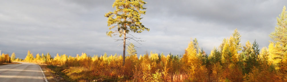
If you are reading this I assume you know something about unsupported cycling and bikepacking, but here are a few reminders. Ruska is a just another bikepacking event where I try to combine all the best parts of the genre, taking something from randonneuring, bikepacking and unsupported bike races. As in the inaugural Ruska in 2017, the route will go across Finland from south to north. Name Ruska stands for autumn foliage and it is the most beatiful time of the year to ride across Finland.
Ruska is not a race, there is just a closing time of the finish line and 2000 km of Nordic roads to compete against. Yet everyone is free to ride as fast as they can. Start is from Turku on friday 14.9. at sunset and participants have until midnight 22.9. to find their way to Kilpisjärvi. That is about 8 days and 3 hours. Results will be posted in 3 categories, finished, late and scratched.
Route goes through three controls points, one of them is a longer parkour. For rest of the route participants can ride any road, path or whatever that is allowed for cycling. Flawless navigation and properly planned route are essential to finishing in time. On this year’s route it means roughly 250 kilometers every day.
There are solo and pair categories. Pairs may help and draft each other, but otherwise they are similar to solos.
Again, if you are reading this and haven’t been living in a barrel for last 5 years, you’ll know something about unsupported cycling ethos. Here is a little briefing of what it means in case of Ruska. You are not allowed to recieve any support that is not available to all racers. During the event you can’t have a friend bring you food. Or make you a new route when you get lost. Or fix your mechanical problems. Or arrange your accommodation. Or warn you about meteorological mayhem. Only thing your friends and fans are allowed to do is cheer you online and bite their nails when you are riding to a deadend. Also you are not allowed to help other participants, unless there is an emergency. Any prolonged riding with another participant is considered forbidden help and drafting obviously is not allowed at any time. You are allowed to use any public and commercially available services. During the event you can use shops, restaurants, hotels and other services as usual. These include any online resources that are available to everyone. You may recieve help, like asking directions or filling water bottles, from locals as long as support isn’t self arranged. You may also call home or chat with friends as long as it doesn’t include any dedicated help. Riders may not consult other riders about their riding plans. Everyone is to make those decisions on their own. It is solely participants own responsibility to follow the rules. You may have a cunning plan to break these rules. Then, if you can’t provide a proper explanation for breaking the rules, you can still have a nice ride across Finland, but you will be listed as scratched in results. Or if the breaking of rules looks blatant, removed completely from the results. And the world will have a good laugh.
In the inaugural edition we had 18 participants and 13 finishers. There is unlikely to be limit to the number of participants as there are no logistical limitations to that. Live tracking of riders will be done with mobile phones. Price is to be confirmed, but it should be between 5 and 20 euros to cover all the needed brevet cards, bells and whistles.
Details about registration will be communicated later with the newsletter.
Getting there and back
Start at Turku is accessible by train, bus, ferry or airplane. I assume finnish participants know their best options. For those who fly to Helsinki there are bus and train connections to Turku. There are also 4 daily ferries from Stockholm to Turku.
From Kilpisjärvi things are a bit more complicated. There are bus connections to Tromsø airport which is the nearest with daily connecting flights to Oslo and wherever you want. There is also bus connection to Rovaniemi. From there you can go by train to anywhere in southern Finland.
Remember to check that specific train and bus connection allows bikes.
Bike and equipment requirements
Any street legal 2-3 wheeled human powered bicycle is allowed. You must have front and rear lights. Lights and a reflective garment must be used in all low light conditions.
There is no mandatory helmet law in either Finland, Sweden or Norway.
General information about route and conditions
For finnish riders most of the information here should be obvious. This section is more interesting to foreign participants.
Here are few of the highlights you should know about Finland when deciding whether to participate Ruska and planning your route. You’ll be riding through most sparsely populated regions of all Europe. So there are on average 16 people / km^2 in Finland or roughly 1/10th of typical European country, but it doesn’t stop there. Most live in either south or coast of Finland. Before 2nd control you’ve entered area with little to no population at all. That is something you should keep in mind when planning your route and resupply. Check and double check that services you plan to use are open and available. Opening times of services in smaller cities are very limited. Longest segments without services should be around 100 kilometers.
September is typically the least rainy of the warm months. 1st half the route should have temperatures between 5-15 celcius and 2nd half 0-10 celcius. On clear nights temperature is likely to go below 0 degrees and when it is raining, temperature is typically higher. There is a little risk of snow near the finish.
Finland’s road network is in excellent condition and there are only a few roads that are forbidden from cyclists. Only roads near your route that are not allowed for cyclists are likely to be ring roads around Turku and Tampere. Google street view works on most paved roads. There is no principal reason to avoid smaller gravel roads. They are in good condition when it’s not raining.
Polar circle is shortly after half way of the route. Autumn foliage in the north is stunning. Also after Polar circle the chance of northern lights during the night is more than 50% and at finish line they are seen almost every night. Northern half of Finland is area of reindeer husbandry where reindeer wander around freely. There are about 200000 reindeers and only a few more citizens in Lapland. Finland is known as a land of thousand lakes. There are actually 168000 lakes over size of 500 square meters.
Controls
Here are the controls (see map) and some thoughts about the route. Details of the controls are provided to participants later.
Start Turku
The start will be from Turku castle. It is one of the oldest buildings in Finland. Here are more details. Majestic enough for the start while also being easily accessible to all participants. Starting from Turku also avoids the beaten paths of the previous Ruska.
Route to first control is essentially flat with a few exceptions on Tampere region, should you decide to ride through there. These are the most crowded parts of the route, but traffic is very low on saturday and nearly non existent at night. All rides will have passed the crowded parts before monday morning.
Kuolema, approximately 400 km from start
The first control is Kuolema. Literally Death. And that is pretty much everything there is to it. It is a just small village in Alajärvi that happens to have a special name. The next two villages towards center are called Halla-aho (Frost plain) and Nälkämäki (Hunger hill). Control is there to lead riders north and allow some variance to route choices.
After Kuolema riders will head to Puolanka on route that is, regardless of route choices, nearly flat. From Puolanka starts a long, nearly 300 km parkour to Salla. Puolanka is also where the area of reindeer husbandry starts. Route will go through the hills of Syöte which were also part of Ruska 2017. Syöte has three nice climbs and they are atleast trying to take road cycling seriously so they are worth visiting again. Iso-Syöte is the southmost fell (a hill with no trees groving naturally on top) in Finland.
Salla, approximately 1100 km from start
The second control is Salla. More precisely the control will be at top of Sallatunturi (Salla fell). Start of parkour is from Puolanka that, depending on how you calculate it, is in the middle of Finland. Sallatunturi however claims to be in the middle of nowhere. There were a few other locations nearby I was hoping to have as control, but they weren’t accessible by bike as cycling is not allowed in certain national parks.
From Salla riders will head west and there are only a few route options. Half way to next control they will cross Tornio river and Sweden’s border. Most of the route remains flat. This is Finland after all.
Esrange, approximately 1650 km from start
The third control is Esrange space center. Space is always interesting, but very reason for Esrange is it being one of the tracking stations of Galileo navigation satellite system. I hope it remind the riders of the nice people who keep their navigators running smoothly. Also I think none of the participants has visited it before.
From Esrange to finish there will be two ways to choose, and maybe a few more for daring adventurers. Other route via Norway is hillier and the other via Finland is almost flat, but regardless of what you choose you will have to climb from Skibotn to Kilpisjärvi, about 550 meters. Start is from Hatteng so that the route options would be almost identical length.
Finish Kilpisjärvi, approximately 2000 km from start
The finish is at Kilpisjärvi. As the inaugural edition finished in the, nowadays nonexistent, right arm of Finland, the second edition will finish in the left arm. There was a little pressure to have the finish at Muotkatakka, the highest point of finish roads, but it would be 20 km ride to climb extra 30 or so meters from what you already pass at Norway’s border.