I haven’t usually written a separate story about Ruskas as I mostly share them in social media as they happen and publish a chronological photo album that has the key points of the story. Here are links to this year’s photos of the ride and photos of other participants.
For those who accidentally end up to this post, here is some key information. Ruska is a approximately 2000 km bicycle ride across Finland in maximum of 8 days in September through the autumn colors. Route is different every year. I’m the organizer and I’ve also made the event’s rules. Rules mostly follow those in other solo(/pair) self supported bicycle events and brevets. There are however some limitations further you progress. Also after 10 finishes you may need to find other hobbies as you may only finish the event 10 times. Though I expect such riders will find their way to finish on their own and maybe help scouting next year’s controls on the way and so on. As this was the 9th event none’s got that far yet.

Restrictions are that for 7th and 8th finish you may not use gps or any other locating tools. For 9th finish also maps and any other notes about route are forbidden except within 5 kms from the event’s mandatory points such as controls or parkours. For 10th you will also at start and at each of the controls get a via point you need to use before next control and you won’t know it until you’ve reached the previous control.
There are now 2 participants with 6 finishes, one with 7 and me with 9. So the story you are about to read is about how the ride went and especially notes about practicalities for future discussion.
You can find Ruska 2025 route here and my route here.
Worries before the ride
As I was not allowed to use social media (too many maps in posts and ride related topics) I had to use one way publishing tool (Buffer) for social media. Raimo who was doing the daily reports would have to be my secretary to send me emails about anything I might have to be aware of. He also did very good job at not informing me about any event related info. So I moved almost all the usual apps away from phone’s home page, and during the ride I even had to move Flickr away as I accidentally had tried to find a photo of a crossroads that I knew I had a photo of. Which would have counted as use of a cue sheet. Road side maps and info tables are allowed, but photography of them (or more precisely, using the photos for own benefit) is not. Similarly asking locals for directions is allowed, but might cause akward discussion because none asks directions anymore.

The route I had was obviously going to be quite conservative as I had to remember it all. Meaning no riding on trails or creative shortcuts. Also shelters and accommodation options would have to be relatively clear before start. As this year had a long parkour, 200 km or 10 % of overall distance, it helped a bit regarding planning. If this sounds complicated, remember that the participant has already ridden across Finland minimum of 8 times, likely more. Even though I had few hundred km of roads I’d never ridden, most I was already familiar with.
Also this is how much of riding happened before gps devices anyways. I had been riding around for 10 years before I got my first gps and often maps of regions would be quite vague.
So with my plan I was quite confident I’ll end up at Haapajärvi without too many issues on the first day and from then on it was going to be familiar routes for the remaining week. Just chant ”638, 637, Sumiainen, Elämäjärvi” and you’ll be fine. From then on it would mostly be about focus and confidence. As getting unlost when you don’t have map or gps can be extremely hard.
The ride
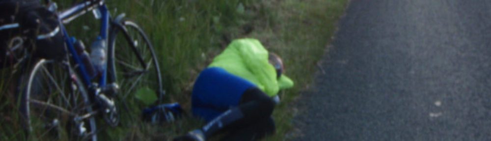
A relief. No social media for a week. 10 km after start I only saw one light behind me and that slowly disappeared. I didn’t expect many participants to head to road number 4 even though it was a lot more flat option and you could ride almost all the usually heavy traffic segments in the middle of a Friday night. I was a bit confused when road 140 crossed road 4 twice at Lusi, but just following road signs was enough. Then there was a short detour after Hartola where cycling on road 4 was forbidden, but no issues there as it was well marked.
From Toivakka I could follow road I’d ridden a year before until Vaajakoski. I ended up hiking over the roundabout cause I couldn’t find the cycle path out of ABC. Though I could’ve ridden the road too. Next up was a roundabout to road 638 and soon after that the road 637 that I would follow until I get back to road 4 at Konginkangas. There was about 10 km of gravel, but on a 3 number road that is rarely an issue.
At Viitasaari I again wasn’t quite sure how the route should go. I turned around to go by the shops and not divert too far from road 4. Getting unlost would’ve been easy there, if nothing else worked just ride the road 4, but I found the correct cycle path for another few kms.

From Elämäjärvi I turned to Haapajärvi. 10 km more distance to Kärsämäki, but a very quiet road. Rest of the roads to Vaala would be the same as my last year’s route. At Pyhäntä’s Sale I had first rule issue as I was talking with another participant. He just casually noted he is not going to ride all the remaining 72 km to the start of parkour. While I had been struggling to remember how long the distance was going to be. Someone with a map would’ve hardly benefitted from the information, but I obviously did. I did mention it to him and all the discussions with other riders are always a bit absurd as you can’t really talk about anything, even and especially, the weather.
Akwardly the first real navigation error happened in the area that I had a map of. At Nuojua I turned towards Utajärvi because I had just remembered turn left after the railroad. Direction was correct, but too early. I was on wrong side of the river. After one km I was sure I was on a wrong road as there was supposed to be a hydro electric plant just after the turn. Along the parkour I also missed a few other turns due to sloppy navigation and riding same climbs twice near Halla. Biggest issue was with distances. As path to Tervatehdas and the following gravel were slow I wasn’t very confident about whether the distance from the airstrip to Suomussalmi was 30 or 10 kms even though I had ridden it in the summer. It was 12 and I made it to the shop without issues, but I didn’t know it until I reached the town.
After 1st control I nearly missed a turn to Näljänkä because I thought the crossroads was the other way. Luckily I was reading the signs even though there was thick fog and night. I had never ridden the road from Näljänkä to Puhos so I had no idea of its condition or profile. As the fog was extremely thick I also missed the shelter next to Iijoki bridge at Ervasti. It was just impossible to see it even though I was like 20 meters away and I knew it was supposed to be there. Instead I continued to Tulitauko’s smoking area for sleeping.

While having brunch at Tulitauko I called and booked a room from Auttin kyläkartano. I got the room and started planning for schedule. I tried to check the opening hours of Autti’s shop, but I couldn’t find anything. I was a bit confused, even closed shops usually return some mentions in Google, but I thought maybe I just remember it wrong and there is no shop. Then at Ranua I bought enough food until Kemijärvi unknown kms away. I had no exact recollection of distance to either Kemijärvi or exact distance from 942 road to turn to Kivalos (was 9 km, could’ve been anything between 5 and 20). I also missed the turn to Kemijärvi at first. I left shop to wrong direction, towards Posio. I hadn’t ridden the road 942 in past 11 years. Yet I was absolutely confident that the turn was in the city. As I reached the outskirts I turned around and the correct crossroads was one block the other way from the shop. Also distance to Kemijärvi (129 km) was a lot shorter than I remembered (something less than 200). Though I still didn’t have any clear idea of how long it is to road 81 and whether I’ll make it to CP 2 before sunset.

I hike-a-biked around the parkour when it was getting dark and reached Autti before midnight. Some other participants had arrived there earlier and more were still to come. I got a breakfast for 6:30, woke up, ate it, and went back to bed. Finally continuing sometime after 9 o’clock. After crossing the bridge I noticed Pirttikoski’s K-market. For obvious reasons I couldn’t find Autti’s shop because the village on the other side of the river has a different name. As I’d eaten the breakfast at hotel I had food all the way until Sodankylä and hence I had over 24 hours between two shop resupplies.
From Sodankylä everything was literally straightforward. Same road for about 160 km. I tried looking for a shelter near Saariselkä, but didn’t find anything. Stopped at the Saariselkä’s 24 h R-kioski for a little resupply and filled water bottles. I ended up sleeping at a bus stop near Ivalo 5 meters from road 4. Until 10 o’clock. The traffic didn’t wake me up even once. A kid waiting school bus at the bus stop briefly woke me up.
To Tsarmitunturi and back went more or less as expected. I had climbed there few days before midsummer. It was 6 degrees at the top and below 0 when I got back to Ivalo. Now it was 14 degrees and more or less the same when I got back. I was planning to continue to Inari, resupply and start early in the morning. At Ivalo I called to two hotels in Inari, but they were both full. As I wasn’t confident I’d actually find any other accommodations from Inari I decided to walk across the street to a hotel in Ivalo and got a room there. I resupplied with a plan to ride to Inari by 7 o’clock when their shops open. This was the 2nd night indoors and only 10 hours and under 100 km since waking up so I was I bit worried if I would catch sleep early enough as it was only 20 o’clock when I settled to my room.
I also ran into rules issue Googling Tievabaari’s opening hours. The first thing on their webpage was ”110 km to Inari”. Though that wasn’t the information I was looking for it still helped mentally when leaving Inari as I’d never ridden the road before.
I woke up around 5 o’clock and reached shop in Inari for usual resupply. I was hoping to get some breakfast at Neste, but as I had a bag full of food and they didn’t have any specific breakfast offers I just took a coffee and continued.

The ride to Tievabaari went smoothly. Like most others there I ate a reindeer pie. I bought few chocolate bars and half a litre bottle of Pommac. After that I messed most of the distances in my mind. I recalled the turn to Lompolo being 15 km away, it was 30 km. As there weren’t any other roads turning right I was 85 % sure I hadn’t missed a turn. Finally arrived to the correct crossroads. Then I just had in my mind ”10 km, after bridge to left”, as the next crossroads was not in Street view or any other view, but actually there was also a sign to Lompolo there so I didn’t get lost in the wilds.
After getting the stamp from Lompolo I was getting a bit worried. Hetta was 85 km away, not 45 as I had remembered. So Nunnanen was 40 km away, not 20 as I had remembered. Meaning I definitely won’t make it to Hetta while there are shops open, maybe won’t make it to Kalmakaltio before sunset and won’t have much food left for morning. I also would have to make some more water with purification pills as I had less than a litre left.
I made it to Kalmakaltio just after sunset and made it back to the road when it was almost dark. I was happy I didn’t need to use a map to find a way down in the dark. I made a few wrong turns, but then I found the right path down. Otherwise I still remembered the way from 2022 when route last visited Kalmakaltio. I sat down next to the road I had to decide what to do next.
As shops wouldn’t open until 8:30 in Hetta I would still have to go to a hotel breakfast before that. I didn’t have much water left so I’d have to get out the purification pills and wait about an hour to drink. There was plenty of water everywhere of course. I decided to call a hotel in Hetta and get a room instead. I was planning to sleep at Yrjö Kokko shelter 10 km before Hetta, but as I anyways needed water and the hotel breakfast, I just checked into the hotel instead of camping out.

From Hetta it was 300 kms, but just 5 more turns to finish and they were more or less the only turns on the roads. I was at that point very confident I’ll make it to finish. I had never been to Lakselv or the finish before, but the anti-navigation plan was good enough. If I miss the turn after the cliff ends and reach the camping site, I’ll just make u-turn and take the first turn right. As there are no street signs on the road to Stabbursdalen trail. I reached the finish around 2:30 on Saturday with 21 hours to spare.
Summary
The issues I faced had very little to do with navigation and everything to do with services. They didn’t fundamentally change the route or schedule, but affected riding and planning on the go a lot more than I expected.
My route was mostly on roads I’m familiar with and I never got lost, so I didn’t have to spend time to get unlost. This definitely would’ve been harder, for example, in 2023 when start was from Liepaja and there are no signs in Sweden for the cyclepaths around E4.
I’m also already quite uneasy about how I’ll manage the 10th time, but that we’ll see next year. 🙂
